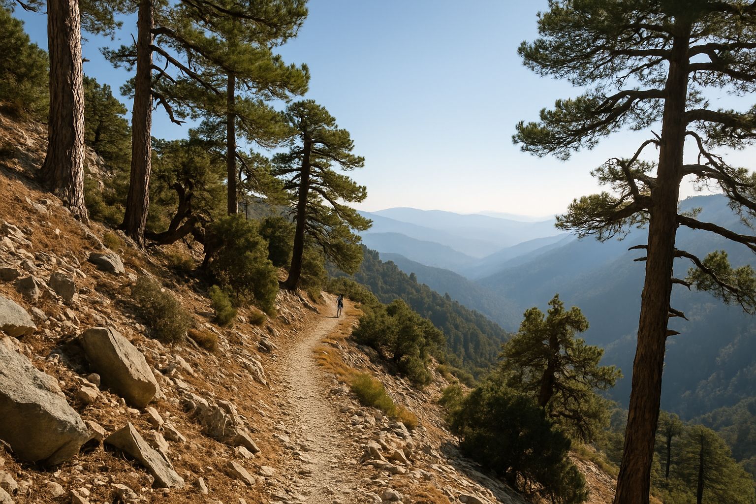
Both are nature trails laid out by the Department of Forests inside the Troodos National Forest Park, which is also a Natura 2000 site, and they could hardly be more different. Atalanti is a 14 km circular walk from Troodos Square around Chionistra, the summit of Mount Olympus and the island's highest peak, and takes four to five hours. Chrysovrysi is a 1.5 km path that starts about 7 km down the road towards Karvounas and drops through pine forest towards the village of Amiantos. The Department grades both 2 on its scale from 1 (easiest) to 3 (hardest) and gives March to November as the best time to walk them.
Atalanti, the loop around Chionistra
The trail is named after Atalanta, the huntress of Greek myth and protégée of the goddess Artemis, and it runs lower than the Artemis trail, which circles the summit itself; where the two come close you can combine them. It starts from Troodos Square at 1,725 m and stays mostly between 1,700 and 1,750 m, with a high point of about 1,820 m. The path runs through dense stands of black pine and foetid juniper (Juniperus foetidissima), and the Department of Forests says one of the largest junipers on the way is 800 years old. Look out for old trees scarred by lightning and by resin tapping long ago, and for information boards on the mountain's plants and on rocks such as pyroxenite, dunite and harzburgite.
According to the Department's route description, there is a tap with drinking water and wooden benches about 3 km from the start. At about 5 km you pass the entrance of an old chromite mining gallery, which the Department says has been out of use since 1982. On the Geological Survey's maps its position matches the Hadjipavlou mine, which the Troodos Geopark describes as the smallest chromite mine in Cyprus, worked on and off from 1950 to 1954; 1982 is when chromite mining in the Troodos ended altogether. After about 9 km the path meets the Troodos to Prodromos road. Cross it, walk about 200 m along the forest road towards Agios Nikolaos tis Stegis to a wooden sign, and the path runs back to the square almost parallel to the main road; you can also walk back along the road itself. The views reach over villages of the Limassol, Paphos and Nicosia districts, and birds to watch for include the endemic Cyprus wheatear, coal tits, crossbills and jays; with luck you may see a mouflon.
Chrysovrysi, the old path to the asbestos mine
Chrysovrysi starts on the Karvounas to Troodos road, on the left as you drive up from Karvounas, 300 m from the stone Chrysovrysi fountain, where the Department of Forests' trail booklet suggests filling your bottles with its cool artesian water before you set off. Villagers from the surrounding communities once used the path to get to the Amiantos mine. It heads downhill through Calabrian pine with golden oak, strawberry tree and terebinth, over gabbro, one of the rocks of the Troodos ophiolite. The last 300 m follow a dirt track that Amiantos farmers have long used, among plane trees and wild cherries, and the path ends on the Karvounas to Amiantos road, about 1.4 km from the village.
The official time is an hour for the 1.5 km one way. As it is a linear trail you walk back the same way, about 3 km in all with roughly 240 m of climbing on the return, so allow at least two hours. The nearest mapped car park is the Botanical Garden's, about 1.35 km along the main road from the start. One more thing to know: Chrysovrysi is still in the Department of Forests' trail map data but is missing from its current online trail list, so ring the Troodos Forest Division on 22608512 before you go.
Add the Botanical Garden and the Geopark centre
Both sit inside the old Amiantos asbestos mine, which was worked from 1904 to 1988 and where restoration began in 1995. The free A.G. Leventis Troodos Botanical Garden lies at about 1,400 m beside the Karvounas to Troodos road, about 1.35 km along it from the start of Chrysovrysi. It holds about 200 plant species, and its viewpoint looks down to the coast at Limassol and Akrotiri. The Department of Forests asks visitors to come on working days between 09:00 and 14:00, when the garden's visitor centre is open (25550092). The Troodos Geopark Visitor Centre, in the mine's old primary school, opens daily from 09:00 to 16:00 except on public holidays, so it is shut on 28 October, and the mine gate is locked when it closes. The older official Geopark site lists entry at 3 EUR for adults and 2 EUR for children, so check on arrival. The garden and the centre are about 20 minutes apart on an internal footpath.
When to go
The Atalanti leaflet warns that parts of the trail can be slippery, and the mountain is much cooler than the coast. From October to April, average daytime highs at Prodromos, the Department of Meteorology's mountain station, run roughly 6 to 11°C below Larnaca and Paphos, and Troodos Square, higher up, is colder still. In the last two winters the first snow fell on 24 November 2024 and on 16 December 2025; there was snow as late as April in 2025 and into March in 2026. In January 2026 the Department of Forests closed Atalanti and 14 other Troodos trails because of erosion, landslides, snow and frost, and their reopening was announced on 26 April, so in winter check the Department's notices before setting out.
Daylight is the other limit. Sunset at Troodos is at about 18:08 on 21 October; after the clocks go back on 25 October it is 16:56 on 1 November and 16:38 on 1 December, so start the full loop by about 10:00. In January 2026 two walkers aged 21 and 23 lost their way on Atalanti after dark and were found unhurt by police and fire service rescuers. Hunting is allowed on Sundays and Wednesdays from 1 November to 27 December 2026, and from 3 January to 28 February 2027 plus Saturday 27 February. We found no rule closing the whole forest park to hunters, so wear something bright on those days.
Getting there
By car, Troodos Square is just over an hour from Limassol, about an hour and 20 minutes from Nicosia or Paphos and two hours from Larnaca by route-planner estimates; allow longer on the mountain roads. The Department of Forests tells Atalanti walkers to park in the square's car park; the start of Chrysovrysi is about 7 km, ten minutes, further down the road towards Karvounas. By bus, EMEL route 64 leaves Limassol's Old Port at 09:16 and reaches Troodos Square at 10:40, coming back down at 15:30, which is too tight for the full loop; in the national timetable data for the week of 20 October it runs Tuesday to Friday, so check the day's times before you rely on it. From Nicosia, NPT route 408 runs on Saturdays, Sundays and holidays, leaving Makario Stadium at 08:00, 11:00 and 14:00 and coming down from the square at 10:00, 13:00 and 16:00, about 1 hour 25 minutes each way. For Chrysovrysi the nearest stop is at Karvounas, on NPT routes 408 and 87, about 1.8 km down the main road from the start.
Safety and rules
Lighting a fire anywhere on the trails is forbidden; in the forest, fires are allowed only in the barbecue spots of official picnic and camping sites. Report smoke on 1407 (free) or 112. Bicycles and motorbikes are banned on all nature trails. The Department of Forests asks walkers to stay on the marked path, wear non-slip shoes, carry a map, phone, water, hat and waterproof, tell someone when they set off and when they expect to finish, and stay off the trails in strong winds and storms. For current conditions ring the Troodos Forest Division on 22608512, or call in at the Department's visitor centre 200 m west of Troodos Square, open on weekdays from 09:00 to 14:30 (1 EUR, free under 6). If a day in the mountains turns into thoughts of a longer stay, our relocation help can take the paperwork off your hands.
