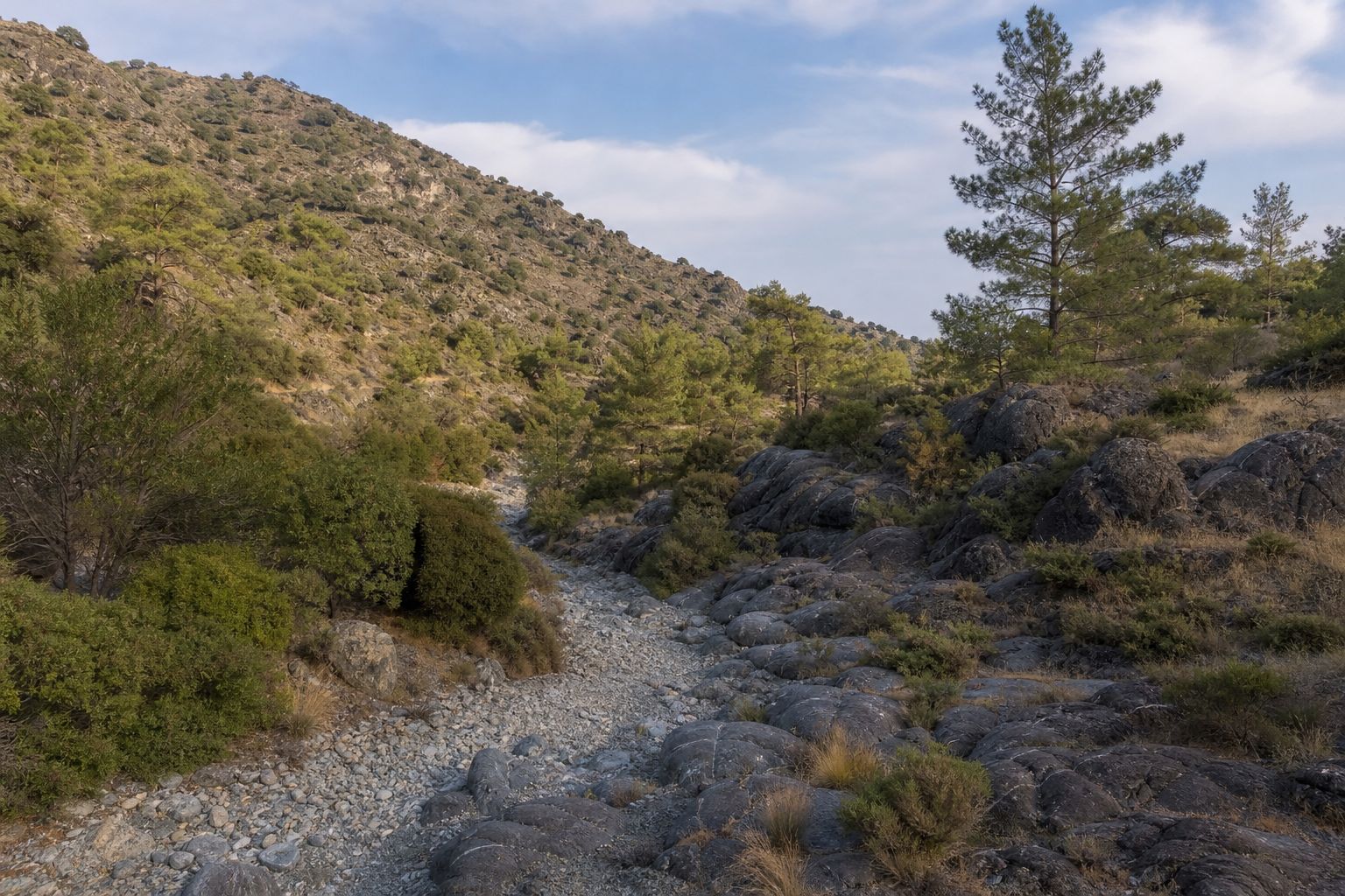
Kalo Chorio Oreinis (Καλό Χωριό Ορεινής), often written Kalo Chorio Orinis and locally also called Kalo Chorio Klirou, is a hill village in Nicosia district about 26 km south-west of the capital in a straight line. By road it is about 30 km, through Strovolos and Lakatamia and out along the Palaichori road past Deftera, Arediou and Klirou, roughly 35 minutes without traffic. It had 747 residents at the 2021 census and sits at about 500 m among pine-covered hills, with Klirou, Mitsero, Agios Epifanios Oreinis and Gourri as its neighbours. Its draw is the gorge of the Maroullena river on the edge of the village, a classic place to see the ocean-floor rocks of the Troodos ophiolite.
The geosite at the old bridges
The walk starts at two old stone bridges over the Maroullena, about 1 km by road from the village centre. The community council says they were built under Venetian rule and widened on their south side in British times; the Department of Antiquities does not list them as monuments, so treat the Venetian date as local history rather than a confirmed one. Right beside them is Geosite 3 of the Troodos UNESCO Global Geopark, a reference exposure of the Lower Pillow Lavas. The Geological Survey Department describes a lower layer of hyaloclastite, a breccia of black volcanic glass from underwater eruptions, overlain by rounded pillow lavas, with both cut by swarms of near-vertical dykes: the channels that carried magma up to the floor of the Neotethys ocean about 92 million years ago.
The International Union of Geological Sciences lists the outcrop among its geological heritage sites, and since 2002 Cyprus's UNESCO World Heritage Tentative List has carried a natural site called Klirou Bridge, listed for its dyke swarms, whose coordinates fall on this stretch of the river. Some tourism pages say the bridges themselves were nominated for the World Cultural Heritage List; the UNESCO list carries only this natural entry. Look for the pitch-black glassy edges on some dykes, where the magma chilled against wet volcanic glass, and for gas bubbles stretched out almost horizontally, which show that the magma flowed sideways rather than straight up.
The first 500 m or so of the trail threads through the gorge on wooden steps and a boardwalk, and crosses the river on a 14 m metal footbridge that the Geological Survey Department, the community and the Geopark's management company put in after floods destroyed the earlier walkways. The valley is also a Natura 2000 site (CY2000010) for the Cyprus grass snake, which lives in its pools, and the community's trail leaflet asks walkers not to move or roll stones in the riverbed. It also warns that climbing down into the side gorges is very dangerous and that the riverbed should be entered only when no water is flowing.
The Pikrovrysi tis Merikas trail
The trail takes its name from the Pikrovrysi spring at its start and from Merika, a medieval settlement at its far end. It runs 4.7 km one way from the bridges to the community's Merika picnic site, a gentle climb of roughly 120 m from about 430 m at the river to about 555 m at Merika. The community council built it in 2015 with EU rural development funding, manages it and puts the walk at about an hour; the Troodos Geopark lists it as trail N71, linear, 1.5 hours and grade 1 to 2 (easy to moderate). It is not a Department of Forests trail. You can walk back through the village, and near the Merika end, the community says, it meets the E4 European long-distance path. After heavy rain, ring the council on +357 22 633697 before you go.
The Merika picnic site is the community's own: its 2018 trail leaflet lists wooden tables, a barbecue, drinking water and toilets, and fire is allowed only in the barbecue area (report any fire on 1407). About 1 km further south-west is the Kalo Chorio dam, a 9 m gravity dam holding 82,000 cubic metres, which the Water Development Department dates to 1947 (the community says 1945 to 1946). The council also mentions old mine galleries at Kokkinorotsos, worked for copper and later for ochre, and part of the small Askopelos state forest on the higher ground inside the village boundary.
Churches, a boat model and an old water gallery
The old church of Agios Georgios, in the old core of the village, is the only building here on the Department of Antiquities' list of ancient monuments (Schedule B). According to the community council it was built in 1633 and renovated in 1833, a single-aisled, barrel-vaulted church of mountain stone whose bell tower was added in 1912. Inside are a carved 17th-century iconostasis with 19th-century carved panels and a mid-17th-century wall painting of St George slaying the dragon, framed by 13 scenes of his martyrdom. The large new church of Agios Georgios nearby was begun on 1 August 1993 and held its first service on 7 April 1996.
The council records ancient tombs and finds from the Archaic, Classical and Roman periods. One of them is held by the Cyprus Museum in Nicosia: a clay boat model, probably Cypro-Archaic, found at the locality of Zithkionas, with a helmsman at the steering oar and a look-out in the crow's nest. Near the village centre the council points to an old underground water gallery, a line of eight shafts joined by a deep tunnel, which it says once served the village and its neighbours, still flows in droughts and is older than anyone can date.
Aes Ambelis winery
On the village slopes is the Aes Ambelis winery (Visit Nicosia spells it Ais Ampelis). The company was founded in 1992, building at Kalo Chorio began in 2000, and its three-hectare estate vineyard is planted with the indigenous Morokanella grape, according to the winery. It says it is open all year for visits and tastings, with tours by arrangement, but it publishes no opening hours, and the Troodos Geopark advises calling before you go: +357 99 835663.
Getting there, and when to go
Without a car, NPT routes 65, 66 and 67 link the village with Tamasos Bus Station in about 10 minutes, and route 2 runs from there to Solomou Square in central Nicosia in 45 to 55 minutes, so allow 1 to 1.25 hours each way with the change. Together, the three village routes have about 20 departures each way on weekdays, 11 on Saturdays and 8 on Sundays in the current timetable. Wednesdays have the full weekday service in the timetable valid from 30 October 2026 to 27 January 2027; check the times on publictransport.com.cy before you travel.
The winter hunting season for hare, partridge and francolin runs on Sundays and Wednesdays from 1 November to 27 December 2026, from sunrise to sunset, according to the Game and Fauna Service: walk on another day, or wear bright colours. Bring water and start early on hot days. Nearby, Fikardou, the preserved mountain village on the UNESCO Tentative List with its folk museum house, is about 9 km away by road, and Machairas Monastery about 16 km. If the hill villages within reach of Nicosia have you thinking about a move, our relocation help is here when you need it.
