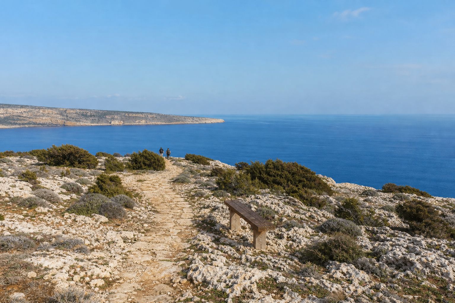
Kavos is a short circular walk round a rocky hill in the Cape Greco National Forest Park, at the south-eastern tip of Cyprus, about 7 km east of Ayia Napa. The Department of Forests' trail booklet and Visit Cyprus give it as a 1.2 km loop of about 45 minutes, grade 1 on the department's scale of 1 to 3; the department's online trail list says 2.5 km and grade 2, but its own map of the trail measures about 1.15 km. It starts and ends at the old quarry car park, climbs to the top of the hill at about 70 to 80 metres and drops to about 30 metres on the south side. There is no drinking water on the route, and the department rates it suitable all year round. No closure of the Cape Greco trails was announced in 2025 or 2026.
Where Cape Greco is, and who looks after it
The Department of Forests calls Cape Greco the south-eastern tip of the island, and it lies in Ayia Napa municipality, south-east of Protaras. It is often described as the easternmost point of Cyprus, but that is not accurate. The national forest park was declared on 18 February 1993, covers about 385 hectares and is run by the Department of Forests of the Ministry of Agriculture, Rural Development and Environment, with 16 km of signed trails and a 4 km cycle path. The whole park lies inside the Natura 2000 network, in the Kavo Gkreko Special Area of Conservation and the Kavo Gkreko Special Protection Area for birds. The tip itself, with its working lighthouse, is state forest outside the park on the department's own map.
Walking the loop
From the old quarry the path climbs gently through pines to the top of Kavos, then drops and circles below the hill's south face back to the start; the department describes slight upward and downward gradients around the hill. After the pines come low shrubs: Phoenician juniper, lentisk, wild thyme, prickly burnet and the endemic Cyprus bosea. Look out for marine fossils in the rock, which the department mentions on this route. The rocky top has benches, and the view runs south over open sea, west to Ayia Napa, north over the park and east to the low tip of the cape and its lighthouse. Older guides mention a French radio station at the tip, but its seven tall antennas were demolished in November 2021.
Take care on the south side, where the Department of Forests warns of steep, rocky cliffs. The same cliffs are a known climbing area: Visit Cyprus lists Cape Greco with more than 180 climbing routes, 10 to 35 m high and graded 5a to 6c, which are for equipped climbers only, not walkers. The whole loop also lies inside a Department of Civil Aviation drone zone, where flights need the National Guard's approval.
Making it longer: the coast path, the arch and the chapel
At its southern point the Kavos loop passes within about 30 m of the coastal Sea Caves to Agioi Anargyroi trail, 4 km and about 1.5 hours one way, grade 1. Heading west, that path reaches the sea caves after about 1.3 km; heading east and then north, it passes the natural limestone arch of Kamara tou Koraka after about 2 km and reaches the chapel of Agioi Anargyroi after about 2.5 km (our measurements on the department's trail data). The little church is built over a sea cave, with stone steps down to the cave, where hermits probably lived at times. Nearby, the Agioi Anargyroi picnic site has drinking water, toilets, barbecues and a play area. From the chapel another trail continues to Konnos beach, where a 1.7 km loop leads to the Cyclops Cave, and the 2 km Aphrodite trail starts at the visitor centre car park.
The sea caves: look, do not jump
Jumping from the cliffs at the sea caves is banned. In August 2025 the Joint Rescue Coordination Centre reminded the public that approaching the sea caves and diving there are strictly prohibited, because a Geological Survey Department inspection had found the ground dangerous through increased erosion. On 22 May 2026 the Department of Forests put up a temporary fence at the caves, together with the rescue centre, the Geological Survey Department, the Department of Environment and the Fire Service, to stop the jumping and protect the unstable rock. Some people still go round it, the Cyprus Mail reported in July 2026, and the department said there was no set plan to remove the fence. A 21-year-old man died in a diving accident there in 2022. Stay behind the fence and see the caves from the cliff path or from a boat.
Birds and plants
BirdLife International lists Cape Greco as an Important Bird Area. Its factsheet, based on a 2012 assessment, calls the south-east corner of Cyprus a key migration site and a raptor bottleneck, with more than 3,000 birds of prey regularly using the area in autumn, mostly honey buzzards, red-footed falcons and kestrels; red-footed falcons and pallid harriers, two raptors of global conservation concern, pass in significant numbers. The endemic Cyprus wheatear and Cyprus warbler breed here, as does the black francolin. The factsheet also warns about illegal bird trappers, while BirdLife Cyprus's autumn 2025 report names Cape Pyla and the Larnaca district as the main trapping hotspots today. Hunting is banned in the park. The Department of Forests counts about 400 plant species, 15 of them endemic. The main shrub is the Phoenician juniper, whose forest the department describes as quite degraded today: its wood was cut in 1912 to 1919 to fuel steam-driven flour mills in the Paralimni area.
Getting there, the visitor centre and the rules
By car, the trailhead is about 8.5 km and 15 minutes from Ayia Napa, about 6 km and 12 minutes from Fig Tree Bay in Protaras, and about 65 km and an hour from Larnaca Airport (our routing, without traffic). On the road from Ayia Napa towards Protaras, turn right for Kavo Gkreko, then after about 1 km turn right onto the unpaved track for Kavos hill, which leads about 700 m to the car park at the old quarry. OSEA buses 101 and 102 stop at Kavo Gkreko, beside the visitor centre, about 1 km or 14 minutes on foot from the start, and a ride costs 2 EUR. OSEA's summer 2026 timetable, valid to 31 October, runs them about every 10 to 15 minutes, and last winter's ran every 15 to 20, so check the current timetable on osea.com.cy before you travel.
The Environmental Information and Education Centre in the heart of the park, opened by the Department of Forests in May 2017, opens daily from 10:00 to 18:30 from May to October and on weekdays only from 10:00 to 14:00 from November to March; in April it opens on weekdays from 10:00 to 14:00 and at weekends and on public holidays from 10:00 to 18:30, and it closes from Good Friday to Easter Monday. Tickets are 2 EUR, or 1 EUR for children aged 6 to 11 (phone +357 23 814412). In the park, fires are allowed only at the barbecues of the picnic sites, picking plants and taking rocks are forbidden, and bicycles and motorbikes are banned from all nature trails. If you see smoke or fire, call 1407 or 112. Bring water, a hat and non-slip shoes, and start early in the day. For the arch and other natural sculptures, see our guide to Cyprus's rock formations, and if the east coast has you thinking about a longer stay, our relocation help is here when you need it.
